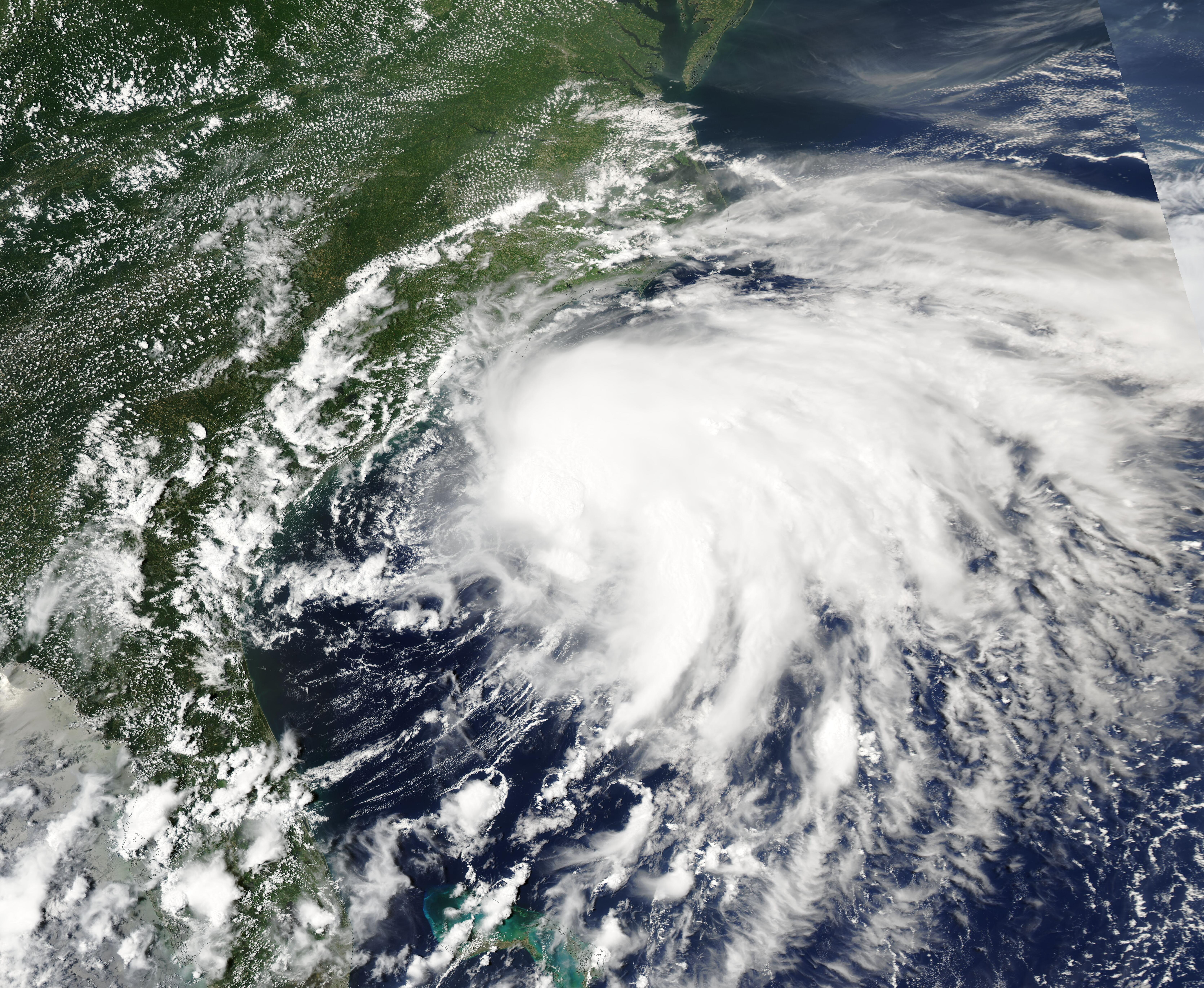
Heavy rain and possible flooding from the remnants of Tropical Storm Isaias could reach Cherry Hill as early as Sunday, the National Weather Service said.
The NWS forecast for the Cherry Hill area calls for a 60% chance of showers Sunday, mainly after 2 p.m., rising to 80% Sunday night. Showers could linger into Columbus Day, Monday, Oct. 12, with a 30% chance before 2 p.m.
The ground is already soaked.
Some parts of New Jersey could see 1 to 2 inches of rainfall, the weather service said, and South Jersey is still saturated from a nor'easter that dumped up to 3 inches on the region the weekend of Sept. 25. That combination raises the risk of localized flooding, AccuWeather reported.
Isaias formed Wednesday, Oct. 7, in the Gulf of Mexico and is forecast to strengthen into a Category 2 hurricane, with a chance of peaking at Category 3, before hitting the central Gulf Coast late Friday night, according to the Associated Press. It is the first Atlantic hurricane of 2026. AccuWeather called it the latest a season's first hurricane has formed in the Atlantic basin in more than a century.
By the time the storm's remnants reach New Jersey, the system will have weakened considerably. FOX 5 NY meteorologist Mike Woods described what the region should expect: "It's more like tropically-fed showers, so it's more like regular showers coming in that have a lot of tropical moisture, and sometimes they have the potential to give us some pretty heavy downpours."
Forecast models still differ on exactly when the rain will arrive, the weather service noted. NWS Mount Holly, the office that covers Cherry Hill, said on X on Thursday, Oct. 8, that the remnants of Isaias would arrive with rain Sunday. The office's forecast on Wednesday, Oct. 7, had flagged increasing shower chances Sunday and Sunday night.
AccuWeather Chief Meteorologist Jon Porter said the scope and magnitude of flooding from Isaias should be "significantly less" than from Hurricane Helene. Still, the saturated ground across South Jersey means even moderate rainfall could pool quickly.
Cherry Hill residents saw the effects of wet weather firsthand on Oct. 1, when police closed Bortons Mill Road near Brace Road after downed wires forced detours around Challenge Grove Park.
How to prepare
Cherry Hill's Office of Emergency Management advises residents to keep at least a three-day supply of water (one gallon per person per day) and non-perishable food on hand. The township also recommends filling gas tanks before a storm and knowing local warning methods, including TV, radio and text alerts.
The Cherry Hill Fire Department said in a June 2021 post that it maintains two swiftwater and flood rescue teams trained to perform vehicle evacuations during flooding.
Neither Cherry Hill police nor the fire department had issued Isaias-specific guidance as of Thursday, Oct. 8. Residents should monitor the departments' social media channels and NWS Mount Holly at weather.gov for updates as the storm track firms up.